Ancient Persian Battery had been found in Baghdad


How could ancient Persian science have grasped the principles of electricity and arrived at this knowledge?


Biblical clues


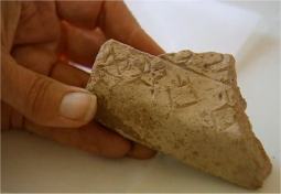
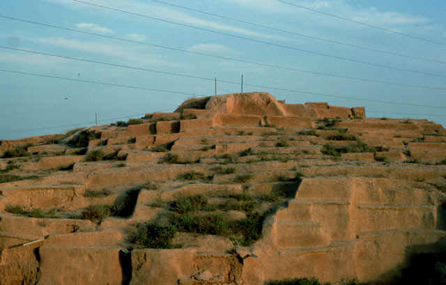
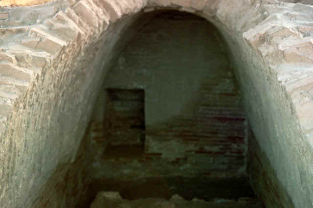
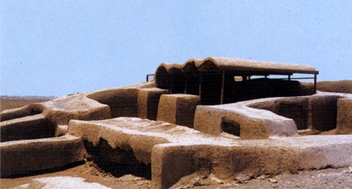
It was in 1938, while working in Khujut Rabu, just outside Baghdad in modern day Iraq, that German archaeologist Wilhelm Konig unearthed a five-inch-long (13 cm) clay jar containing a copper cylinder that encased an iron rod.

Batteries dated to around 200 BC
Could have been used in gilding

The vessel showed signs of corrosion, and early tests revealed that an acidic agent, such as vinegar or wine had been present.
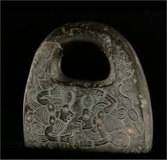
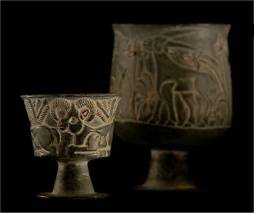
In the early 1900s, many European archaeologists were excavating ancient Mesopotamian sites, looking for evidence of Biblical tales like the Tree of Knowledge and Noah's flood.
Konig did not waste his time finding alternative explanations for his discovery. To him, it had to have been a battery.
Though this was hard to explain, and did not sit comfortably with the religious ideology of the time, he published his conclusions. But soon the world was at war, and his discovery was forgotten.
Scientific awareness
More than 60 years after their discovery, the batteries of Baghdad - as there are perhaps a dozen of them - are shrouded in myth.
"The batteries have always attracted interest as curios," says Dr Paul Craddock, a metallurgy expert of the ancient Near East from the British Museum.
"They are a one-off. As far as we know, nobody else has found anything like these. They are odd things; they are one of life's enigmas."
No two accounts of them are the same. Some say the batteries were excavated, others that Konig found them in the basement of the Baghdad Museum when he took over as director. There is no definite figure on how many have been found, and their age is disputed.
Most sources date the batteries to around 200 BC - in the Parthian era, circa 250 BC to AD 225. Skilled warriors, the Parthians were not noted for their scientific achievements.
"Although this collection of objects is usually dated as Parthian, the grounds for this are unclear," says Dr St John Simpson, also from the department of the ancient Near East at the British Museum.
"The pot itself is Sassanian. This discrepancy presumably lies either in a misidentification of the age of the ceramic vessel, or the site at which they were found."
Underlying principles
In the history of the Middle East, the Sassanian period (circa AD 225 - 640) marks the end of the ancient and the beginning of the more scientific medieval era.
Though most archaeologists agree the devices were batteries, there is much conjecture as to how they could have been discovered, and what they were used for.
How could ancient Persian science have grasped the principles of electricity and arrived at this knowledge?
Perhaps they did not. Many inventions are conceived before the underlying principles are properly understood.
The Chinese invented gunpowder long before the principles of combustion were deduced, and the rediscovery of old herbal medicines is now a common occurrence.
You do not always have to understand why something works - just that it does.

Enough zap

It is certain the Baghdad batteries could conduct an electric current because many replicas have been made, including by students of ancient history under the direction of Dr Marjorie Senechal, professor of the history of science and technology, Smith College, US.
"I don't think anyone can say for sure what they were used for, but they may have been batteries because they do work," she says. Replicas can produce voltages from 0.8 to nearly two volts.

Making an electric current requires two metals with different electro potentials and an ion carrying solution, known as an electrolyte, to ferry the electrons between them.
Connected in series, a set of batteries could theoretically produce a much higher voltage, though no wires have ever been found that would prove this had been the case.
"It's a pity we have not found any wires," says Dr Craddock. "It means our interpretation of them could be completely wrong."
But he is sure the objects are batteries and that there could be more of them to discover. "Other examples may exist that lie in museums elsewhere unrecognised".
He says this is especially possible if any items are missing, as the objects only look like batteries when all the pieces are in place.

Possible uses

Some have suggested the batteries may have been used medicinally.
The ancient Greeks wrote of the pain killing effect of electric fish when applied to the soles of the feet.
The Chinese had developed acupuncture by this time, and still use acupuncture combined with an electric current. This may explain the presence of needle-like objects found with some of the batteries.
But this tiny voltage would surely have been ineffective against real pain, considering the well-recorded use of other painkillers in the ancient world like cannabis, opium and wine.
Other scientists believe the batteries were used for electroplating - transferring a thin layer of metal on to another metal surface - a technique still used today and a common classroom experiment.
This idea is appealing because at its core lies the mother of many inventions: money.
In the making of jewellery, for example, a layer of gold or silver is often applied to enhance its beauty in a process called gilding.


Grape electrolyte

Two main techniques of gilding were used at the time and are still in use today: hammering the precious metal into thin strips using brute force, or mixing it with a mercury base which is then pasted over the article.
These techniques are effective, but wasteful compared with the addition of a small but consistent layer of metal by electro-deposition. The ability to mysteriously electroplate gold or silver on to such objects would not only save precious resources and money, but could also win you important friends at court.
Let's hope the world manages to resolve its present problems so people can go and see them
Dr Paul Craddock A palace, kingdom, or even the sultan's daughter may have been the reward for such knowledge - and motivation to keep it secret.
Testing this idea in the late seventies, Dr Arne Eggebrecht, then director of Roemer and Pelizaeus Museum in Hildesheim, connected many replica Baghdad batteries together using grape juice as an electrolyte, and claimed to have deposited a thin layer of silver on to another surface, just one ten thousandth of a millimetre thick.
Other researchers though, have disputed these results and have been unable to replicate them.
"There does not exist any written documentation of the experiments which took place here in 1978," says Dr Bettina Schmitz, currently a researcher based at the same Roemer and Pelizaeus Museum.
"The experiments weren't even documented by photos, which really is a pity," she says. "I have searched through the archives of this museum and I talked to everyone involved in 1978 with no results."

Tingling idols

Although a larger voltage can be obtained by connecting more than one battery together, it is the ampage which is the real limiting factor, and many doubt whether a high enough power could ever have been obtained, even from tens of Baghdad batteries.
One serious flaw with the electroplating hypothesis is the lack of items from this place and time that have been treated in this way.
"The examples we see from this region and era are conventional gild plating and mercury gilding," says Dr Craddock. "There's never been any untouchable evidence to support the electroplating theory."
He suggests a cluster of the batteries, connected in parallel, may have been hidden inside a metal statue or idol.
He thinks that anyone touching this statue may have received a tiny but noticeable electric shock, something akin to the static discharge that can infect offices, equipment and children's parties.
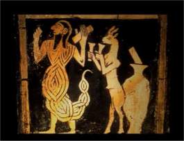
"I have always suspected you would get tricks done in the temple," says Dr Craddock. "The statue of a god could be wired up and then the priest would ask you questions.
"If you gave the wrong answer, you'd touch the statue and would get a minor shock along with perhaps a small mysterious blue flash of light. Get the answer right, and the trickster or priest could disconnect the batteries and no shock would arrive - the person would then be convinced of the power of the statue, priest and the religion."

Magical rituals

It is said that to the uninitiated, science cannot be distinguished from magic. "In Egypt we know this sort of thing happened with Hero's engine," Dr Craddock says.
Hero's engine was a primitive steam-driven machine, and like the battery of Baghdad, no one is quite sure what it was used for, but are convinced it could work.
If this idol could be found, it would be strong evidence to support the new theory. With the batteries inside, was this object once revered, like the Oracle of Delphi in Greece, and "charged" with godly powers?
Even if the current were insufficient to provide a genuine shock, it may have felt warm, a bizarre tingle to the touch of the unsuspecting finger.
At the very least, it could have just been the container of these articles, to keep their secret safe.
Perhaps it is too early to say the battery has been convincingly demonstrated to be part of a magical ritual. Further examination, including accurate dating, of the batteries' components are needed to really answer this mystery.
No one knows if such an idol or statue that could have hidden the batteries really exists, but perhaps the opportunity to look is not too far away - if the items survive the looming war in the Middle East.
"These objects belong to the successors of the people who made them," says Dr Craddock. "Let's hope the world manages to resolve its present problems so people can go and see them."

جستجوى كهن ترين تمدن جهان در جيرفت


: جستجوى كهن ترين تمدن جهان در جيرفت


فصل تازه كاوش در آثار جيرفت كرمان با هدف اثبات قدمت تمدن حوزه هليل رود نسبت به ساير حوزه هاى تمدنى جهان از امروز با حضور ۱۵ باستان شناس ايرانى، فرانسوى، آمريكايى و ايتاليايى آغاز مى شود.

دكتر يوسف مجيدزاده با بيان اين مطلب گفت: تمدن و آثار پنهان در اين منطقه مورد توجه باستان شناسان جهان قرار گرفته است. چرا كه به گمان عده اى تمدن بين النهرين نيز از اين منطقه تأثيراتى پذيرفته است. وى اظهار داشت: در تركيب تيم پژوهشى فصل اخير، متخصصان ميان رشته اى نظير استخوان شناس، زمين ريخت شناس، مرمت گر دنيا و گياه شناس حضور دارند تا باستان شناسى با دقيق ترين مبانى علمى صورت گيرد.سرپرست گروه باستان شناسى حوزه هليل رود افزود: آثارى كه از حفارى هاى جيرفت به دست آمده بسيارى از حلقه هاى گمشده هزاره سوم را در جاى خود قرار داده است.دكتر يوسف مجيدزاده از شرق ايران به عنوان مركز يك تمدن بزرگ نام برد و تصريح كرد: اين تمدن به هيچ عنوان متأثر از تمدن بين النهرين و مصر نيست بلكه بر اين تمدن ها تأثير هم گذاشته است. مجيدزاده در ادامه توضيح داد: از فصل دوم كاوش هاى باستان شناسى در جيرفت به ابعاد يك تمدن بزرگ در منطقه پى برديم و برايمان اين سؤال مطرح شد كه آيا جيرفت خاستگاه تمدن و هنر بين النهرين است؟ وى سپس ادامه داد: سال گذشته يك كتيبه كامل در منطقه پيدا شد كه خط روى آن هم زبان با هيچ كدام از خطوط بين النهرين و مصر نيست و در واقع اين خط قائم به ذات است. باستان شناس برجسته ايرانى به ديگر آثار كشف شده در حوزه هليل رود نيز اشاره كرد و افزود: با كشف آثار و ظروف سنگى و سفالى در منطقه هليل رود متوجه شديم توليدات صنعتى شرق و جنوب شرق ايران به بين النهرين رفته است و از سوى ديگر تاكنون هيچ عنصرى از تمدن بين النهرين در جيرفت پيدا نشده است.دكتر مجيدزاده در ادامه اظهار داشت: با حضور همكاران خارجى در پنجمين فصل كاوش، زمينه استفاده از توان كشورهاى ديگر در اين زمينه، انجام مطالعات آزمايشگاهى بر روى آثار به دست آمده فراهم مى شود. وى اعتبار اجراى اين پروژه در هر فصل كاوش (۷۵ روز در هر سال) را از ۸۰۰ تا يك هزار ميليون ريال عنوان كرد و افزود: اين بودجه كه نوسان آن در هر فصل براساس افزايش يا كاهش هزينه هاست، از بودجه دولتى و توسط سازمان ميراث فرهنگى و گردشگرى تأمين مى شود.وى افزود: اما امروز و پس از چند سال كه فرهنگسازى به صورت جدى مورد توجه قرار گرفته، مى توان با آرامش خاطر منطقه را به صورت كامل به مردم واگذار كرد. وى ابراز اميدوارى كرد: باستان شناسان در همه جاى اين كشور كهنسال فرهنگسازى را مورد توجه قرار دهند. كاوش هاى باستان شناسى صورت گرفته در منطقه هليل رود كه در سال ۱۳۸۰ آغاز شده نشان مى دهد كه در اين حوزه تمدنى ۵ هزار ساله و يا بسيار بيشتر نهفته است.به گزارش خبرنگار ما از هليل رود تا جازموريان بخش غربى حوزه فرهنگى جازموريان است كه در تلاقى گاه ۳ استان كرمان، سيستان و بلوچستان و هرمزگان واقع شده و بسان يك گذرگاه يا راهروى طبيعى بين هند و بين النهرين و دريا با ويژگى ميان فرهنگى است.به استناد باستان شناسان سراسر اين حوزه فرهنگى كه حدود ۱۵۰ هكتار وسعت دارد را مى توان يك محدوده باستانى دانست كه همچون بهشتى گمشده در حوزه شهرى است.اهميت باستان شناسى هاى اخير نيز در اين نهفته است كه تاريخ تمدن در ايران را بسيار كهن تر از بين النهرين و حتى هند خواهد نمود. گفته مى شود كناره اين رود از هزاره هاى پيش زيستگاه هاى دوران پارينه سنگى، نوسنگى، كشاورزى، آغاز شهرنشينى و دوره شكوفايى تمدن بوده است. در تاريخ نيز آمده است كه اسكندر به همراه شمارى از سرداران خود از جيرفت نيز گذر كرده است.


روايتي از تلاش باستان شناسان در پنجمين فصل كاوش هاي باستاني جيرفت


جيرفت كه تا پيش از سال ۱۳۸۰ به لحاظ باستان شناسي شهرت چنداني در ايران و جهان نداشت از اوايل فروردين ماه همين سال و با كشف اتفاقي يك ظرف نفيس توسط يكي از روستاييان منطقه به يكباره مورد توجه خاص و عام قرار گرفت . اگر چه در اوايل بسياري از روستانشينان كه بر اثر خشكسالي چند ساله و مشكلات معيشتي ناشي از آن دانسته و ندانسته به ويراني و نابودي قسمتي از اسناد پنج هزار ساله نياكان خود در طول ۴۰۰ كيلومتر اقدام كردند اما سرانجام در اواخر سال ۸۰ هيأت هايي از سوي سازمان ميراث فرهنگي به منظور انجام بررسي و كاوشهاي باستان شناسي به منطقه اعزام شدند.در بررسي اين هيأتها بيش از ۸۰ محوطه باستاني ثبت و دو تپه كنار صندل شمالي و جنوبي به فاصله حدود يك و نيم كيلومتري از يكديگر در كنار روستايي به همين نام كه از لحاظ وسعت و ارتفاع و موقعيت جغرافيايي مهمتر و چشمگير تر از ساير محوطه ها به نظر مي رسيدند براي كاوش برگزيده شدند .نتيجه نخستين فصل كاوشها از اين مناطق و نيز مطالعه اشياي بازپس گرفته شده از حفاران غيرمجاز نشان داد كه اين آثار به نيمه نخست هزاره سوم قبل از ميلاد تعلق داشته كه در طول آن منطقه جيرفت بزرگترين مركز صنعتي توليدات سنگي و فلز كاري در تمدن شرق بوده است . اما در دومين و سومين مرحله از فصل كاوشها يافته هاي مهمتر ديگري از حفاريهاي تپه هاي كنار صندل شمالي و جنوبي و نيز ساير محوطه هاي باستاني به دست آمد. ما حصل اين دو مرحله بررسي و شناخت بقاياي معماري عظيم خشتي متشكل از توده هاي بزرگ و ديوارهاي قطور ساخته شده از خشت به همراه ظروف و قطعات سفالي و سنگ صابون ، سنگ مرمر و مفرغ و شيشه و به ويژه كشف بخش كوچكي از يك اثر مهم استوانه اي كه بر روي آن علائم خط ديده شده بود توانست چهره باستان شناسي ايران و به خصوص شرق اين ديار كهن را به طور كامل دگرگون سازد. در ادامه اين روند و در چهارمين فصل اين كاوشها نيز آثار و شواهد چشمگيرتري از بقاياي تمدن حوزه فرهنگي هليل رودعنبرآبادوجيرفت به دست آمد كه توانست تاريخ باستان شناسي جهان را تغيير داده و همگان را متحير سازد . بر اساس اين يافته ها ساكنان اين منطقه به لحاظ بعد فرهنگي از مردم سايرسرزمينهاي شناخته شده هم عصر همچون دره سند ، بين النهرين و مصر چندين پله فراتر بوده چنانكه كشف ظروف سنگي و اشياي مفرغي نشان مي دهد كه هنروران آن زمان نه تنها تحت نفوذ تمدني خاص نبوده اند بلكه مكاتب مدوني نيز در كنار خود داشته اند . با اين همه آنچه در چهارمين فصل كاوشها بسيار مورد توجه قرار گرفت كشف ۳۰۰ اثر مهر با ارزش به همراه اشياء و آثار قيمتي و نفيس بود كه نشان مي داد ساكنان اين حوزه مردماني تاجر پيشه و بازرگان بوده اند كه «كنار صندل » يكي از مراكز بزرگ تجاري در ايران باستان بوده است . ..... و حالا هزاران سال پس از اينكه رونق اين مركز تجاري پايان يافته و اين شهر عظيم به خاك نشسته، در صبحگاه يك روز پائيزي از محل پايگاه كاوشهاي باستان شناسي حوزه فرهنگي هليل رود واقع در شهر جيرفت ، به همراه گروه باستان شناسي متشكل از دو تيم ايراني و ايتاليايي به سرپرستي دكتر يوسف مجيد زاده عازم شهر خفته «كنـــار صندل» هستيم . پس از عبور از روي پل رودخانه اي خشكيده در ميانه شهــر و گذر از چندين روستاي بين راهي، تپه «كنار صندل جنوبي » را پيش رو داريم . به محض پياده شدن ، چند توپي حصيري كه گمان مي بريم كپرهاي روستاييان اطراف باشد توجهمان را جلب مي كند و كمي جلوتر نيز كارگراني با پوشش يكدست آبي رنگ وبا ابزاري از قبيل بيل ، كلنگ و فرغون كه دقايقي پيش از ورود گروه باستان شناسي فعاليت روزانه خود را آغاز كرده اند. در ابتداي كار دكـــــــتر مجيد زاده به بررسي ترانشه اي در دامنه و اطراف تپه«كنار صندل »پرداخت و با ارائه توضيحات ، سرپرستان هر گروه را به چگونگي ادامه كاوشها راهنمايي مي كند . او پس از انجام ايـــن كار در پايين تپه دقايقي ما را ميهمان گفته هايش مي كند . صحبتهاي او با اشاره به عده كارگران و نوع كارآنها آغاز شد و اين كه در حال حاضر نزديك به ۸۰ كارگر بومي متشكل از سه گروه كلنگ زن ، بيل زن و فرغون بر در منطقه مشغول به كار هستند . مجيد زاده هر يك از كارگران را بر اساس تجربه و استعداد به انجام كاري گمارده است كه به گفته خودش «كلنگ زن» حساس ترين كار را برعهده دارد و مي تواند به عنوان عضو مؤثري از گروه باستان شناسي قلمداد شود . شناخت كاملي از كارگرانش دارد و آنها را با اسم كوچك و بسيار صميمانه خطاب مي كند.او با «چهــــارشنبه »كارگر بومي كه سني حدود ۸۰ سال دارد صميمي تر است . دكتر مجيد زاده در مورد يكي از كارگران خشت زن هم به نام «شاه مرادي» كه تجربه چهار فصل كار در تپه هاي باستاني را دارد معتقد است او با تفكر خاص و نشأت گرفته از علاقه ، كلنگ ۴۰۰ گرمي را به شكلي به زمين مي زند كه خدشه اي بر خشتهاي زير خروارها رسوب وارد نشود. در ميان كارگران البته جوانترها به دليل نداشتن تجربه كافي تنها به جابه جا كردن رسوبات برداشته شده از محل حفاري مي پردازند. دكتر مجيد زاده مهمترين دليل خود براي انتخاب اين افراد را اشتغالزايي و تأمين بخشي از نيازهاي مالي و فرهنگي ساكنان فقير و تنگدست روستاهاي اطراف عنوان مي كند و بر اين باور است از اين راه ارزش معنوي اشياء و وسايل موجود در دل خروارها خاك منطقه هم در گذر زمان براي ساكنان شناخته مي شود.سرپرست تيم باستان شناسي جيرفت در آغاز پنجمين فصل كاوشها تا حدودي خود را در انجام اين مهم موفق مي داند و عقيده دارد در حال حاضر با ايجاد بستر سازيهاي مناسب ،مردم منطقه خود حافظان اصلي مواريث وآثار به جاي مانده از نياكانشان هستند . وي اصلي ترين دليل وقوع غارتهاي گذشته را فقر مالي و نا آگاهي حفاران بومي غيرمجاز منطقه بر مي شمارد . به همراه سرپرست گروه به سمت ترانشه اي در فاصله ۱۵۰ متري از تپه ها مي رويم . در آنجا با يك مـــــــرد و زن ايتــــــاليايي كه در اين پروژه مشاركت دارند آشنا مي شويم، « اليزا كورستي » دانشجوي فوق ليسانس باستان شناسي كه در حال مطالعه بر روي تمدن شرق ايران است هدف از عضويت درگروه باستان شناسي حوزه فرهنگي هليل رود را علاقه شخصي و تكميل رساله پژوهشي خود عنوان مي كند و مي گويد: مطالعات اوليه ام بر روي يافته هاي شهر سوخته بوده و سپس توجهم به عظمت تمدن جيرفت معطوف شده است . «روبرتوميكلي» نيـــزكه به تازگي تحصيلاتش در مقطع دكتري باستان شناسي (گرايش پيش از تاريخ ) را به پايان رسانده مهمترين هدف خود از سفر به ايران را آشنايي با تمدن منطقه بر مي شمارد و مي افزايد : پيش از سفر به ايران مدتي در پاكستان بوده و سپس كاوش درمنطقه عنبرآبادوجيرفت را براي ادامه تحقيقات و مطالعاتش بر مي گزيند . پس از صحبتهاي «اليزا» و «روبرتو» دكتر مجيد زاده به ارائه توضيحاتي در خصوص ترانشه مورد بررسي تيم اول ايتاليايي مي پردازد و مي گويد اين ترانشه كه بر اساس شواهد موجود خانه اي مسكوني بوده ، به صورت حدسي و غيرتصادفي مورد كاوش قرار گرفته است . در ادامه مسير به سمت توپي هايي كه استراحتگاه ساده و محقر گروه است مي رويم . «آقــــــا جلال» نگهبان اصلي كنار صندل ما را ميهمان يك ليوان چاي مي كند و با لهجه شيرين محلي در خصوص آنچه بر تپه هاي باستاني منطقه گذشته تــــــوضيحاتي مي دهد . باد خنكي كه از لا به لاي منافذ توپي حصيري شكل به درون مي آيد براي لحظاتي چند آرامشي دلپذير به چهره هاي خسته مي دهد. با ساخت اين «توپي ها» مشكل محل سكونت گردشگران و بازديد كنندگان منطقه نيز در نزديكترين فاصله به تپه هاي باستاني حل شده است و قرار است در آينده اي نزديك اين اماكن به تفرجگاهي مناسب در سايت گردشگري «كنار صندل» تبديل شود. ساخت و نصب «توپي ها» علاوه بر اشتغالزايي براي بوميان منطقه، فرهنگ و هنر آنان را هم براي گردشگران به نمايش مي گذارد. بر اساس گفته بومي ها، در تعطيلات نوروزي امسال در همين توپي ها ساكنان روستاهاي اطراف هنرهاي دستي خود را در معرض فروش گذاشته اند و بسياري از اهالي توانسته اند با ارائه قسمتي از توانايي هايشان فرهنگ ايران باستان و عصر جديد را يكجا براي بازديدكنندگان جلوه گر سازند. دكتر مجيد زاده به طرح دايركردن رستوران سنتي در همين توپي ها هم اشــاره مي كند و اظهار مي دارد : با توجه به اينكه نان بومي و خوراك محلي منطقه معروفيتي خاص دارد تلاش مي شود زمينه هاي ترويج و اشاعه آن فراهم شود. اندكي بعد چند نفر از دختران روستاي كنار صندل كه در سال گذشته با گروه باستان شناسي همكاري داشته وبه نوشتن مشخصات فني بر روي سفالها اشتغال داشته اند به منظور بـــــــازگشت به حـــــرفه گذشته شان به نزد دكتر مي آيند . سرپرست گروه باستان شناسي مي گويد: از دو سال پيش با پيشروي كاوشهاي باستان شناسي كه به كشف اشياي مختلف و ظروف شكسته انجاميد دختران تحصيلكرده روستا براي شماره گذاري و ثبت مشخصات موارد كشف شده به كارگرفته شدند تا حداقل از سرمايه اي كه دولت براي آموزش آنها در دانشگاهها هزينه نموده بهره اي برده شود و آنان نيز با كسب حداقل درآمد بتوانند قسمتي از مايحتاج روزانه شان را تأمين كنند . دكتر مجيد زاده با بيان اينكه هر ساله بين ۷۰ تا ۸۰ ميليون تومان به اقتصاد روستاهاي منطقه از محل به كارگيري كارگران در كاوشها كمك مي شود ادامه مي دهد: بعد از شروع فصلهاي آغازين كار باستان شناسان ، تسهيلاتي از قبيل آسفالت جاده منتهي به روستاهاي منطقه و تأمين بهداشت در نظر گرفته شد و قرار است امكانات ديگري از قبيل ساخت درمانگاه و مدرسه نيز به منطقه ارائه شود. حوالي ساعت ده و نيم ساير اعضاي گروه باستان شناسي به محل توپي ها باز مي گردند و كارگران نيز براي استراحتي نيم ساعته راهي منزلشان مي شوند پس از استراحت به پيشنهاد دكتر مجيد زاده به سمت قبرستان« مطوط آباد» مي رويم . قبرستان در انتهاي جاده اي ناهموار و پر پيچ و خم قرار دارد ، در آنجا هنوز آثاري از حفاريهاي غير مجاز كه در اوايل سال ۸۰ به وقوع پيوسته به چشــــم مي خورد و خاطره كشف اتفاقي ظرفي تزئيني - سنگي توسط يكي از روستاييان ســـــاحل هليل رود را به يكباره برايمان مجسم مي كند ،كشفي كه منجر به غارت و ويراني اسناد پنج هزار ساله واقع در طول ۴۰۰ كيلومتري اين حوزه شد و توانست بسياري از روستاييان را كه بر اثر خشكسالي با مشكلات معيشتي دست و پنجه نرم مي كردند براي مدتي كوتاه در رفاه قرار دهد. بر روي سايت قبرستان گودالهايي با عمق چند متر حفر شده بود كه «دانشي» سرپرست تيم حاضر در محل قبرستان ، حفر اين گودالها را به منظور دستيابي به آثاري بر مي شمارد كه در صورت تحقيق مي تواند نحوه تدفين و به خاكسپاري مردگان ايران باستان را آشكار سازد . وي اين قبرستان را متعلق به شهري مي داند كه به احتمال يقين «كنار صندل جنوبي» دژ حكومتي و «كنار صندل شمالي» معبد مذهبي آن بوده است . «دانشي» در ادامه با اشاره به تپه قلعه كوچك كه تنها برآمدگي آن از ميـــــــان درختان نخل روستا مشخص است مي گويد : هفته گذشته بر اثر كانال زني آب منطقه به طور اتفاقي گوري دخمه اي در فاصله دو كيلومتري اين تپه كشف شد كه بر اساس آثار به دست آمده احتمال مي رود اين قبرستان متعلق به اشراف و بزرگان منطقه باشد . او سپس به معرفي اعضاي گروهش مي پردازد و مي افزايد: درحال حاضر تيم دوم گروه ايتاليايي كه متشكل از دكتر ويداله و خانم اليزا مازيولي دانشجوي باستان شناسي است در اين محل مشغول به كاوش هستند كه با دقت بسيار به تحقيق بر روي آثار و يافته هاي موجود مي پردازند . از پيشنهاد گروه براي حركت به سمت قلعه كوچك براي بازديد از گور دخمه اي در فاصله هشت كيلومتري تپه كنار صندل استقبال مي كنيم . پس از گذر از يك بيراهه با سه مأمور يگان حفاظت سازمان ميراث فرهنگي كه ايستاده در زير تيغ آفتاب به پاسداري از محوطه هاي باستاني مشغول هستند روبرو مي شويم. آنها به خاطر بومي بودن و تعلق خاطري كه به منطقه دارند با پشتكاري خاص به حفاظت از منطقه ادامه مي دهند . پس از بازديدي كوتاه از قلعه كوچك و گور دخمه اي تازه كشف شده نزد گروه باستان شناسي مستقر در منطقه باز مي گرديم . حوالي ساعت ۲ بعدازظهر هر يك از اعضاي تيم خسته از كار روزانه با صورتهايي غبار گرفته از محل كاوشها باز مي گردند . دكتر مجيد زاده به محض ديدن هر يك از چگونگي پيشرفت كار سؤال مي كند و اين كه فردا چگونه محل تحت سرپرستي شان را كاوش كنند . در طول مسير ۱۵ كيلومتري بازگشت از متن تاريخ خفته در خاك تا شهر جيرفت بيشتر اعضاي گروه در خصوص مسائل مختلف به بحث و تبادل نظر مي پردازند . در پايگاه پس از صرف ناهار و استراحتي كوتاه باستان شناسان گروه كاوش براي بررسي و ثبت يافته هايشان به كارگاه واقع در ضلع شرقي پايگاه مي روند ، به گفته دكتر مجيد زاده اين كار تا پاسي از شب ادامه خواهد داشت


آثار تاريخي : ليست آثار تاريخي شهر به همراه مختصر توضيح راجع به اين آثار وتصوير از اين آثار پيوست شود . از شهر جيرفت به نامهاي ارت ‌ـ مكن ـ گدرـ جارفت ـ جردس ـ جنه اربعه اشهر( بهشت چهار ماه )ـ جيربت ـ دسبوس ـ دقيانوس ـ دوزاري ـ رئوبارلس ـ قمادين ـ كارمانيا ـ كامادي ـ كمادي وسبزواران ياد شده است . اخيرا" شهر جيرفت بر اثر كاوش سازمان ميراث فرهنگي ، قدمت 7000 ساله دارد و داراي تمدن ارت ميباشد . براي اولين بار اين نام در حفاريهاي اخير به منطقه جيرفت اطلاق گرديد ، كه بيانگر رونق و وجود تمدن در اين منطقه در دوره سومر باستان بوده است . دكتر مجيد زاده باستان شناس معروف در كتاب ( جيرفت كهن ترين تمدن شرق ) با توجه به نام ارت جيرفت را كهن ترين تمدن شرق مي داند . اشياء كشف شده در ساختمان موزه شهر جيرفت در پارك حاشيه هليل بنا شده و مورد بازديد علاقمندان قرار دارد ، شامل : سرديس و تنديس انسان و جانوران ازسنگ مرمر . پيكره انسان و جانوران از سنگ صابوني . پيكره انسان و جانوران از مفرغ يا بخشي از اشياي تزئيني پيچيده تر. افزون بر ظروف ، گونه هاي متعددي از اشياء متفاوت از همان سنگ مانند چهارپايه ( به احتمال نماي معبد ) با شباهت بسيار زياد به يافته هاي مشابه از حفريات شهداد . سفال منقوش يا ساده شبيه سفالهاي به دست آمده از شهداد ، تپه يحيي در كرمان و شهر سوخته سيستان كه تاريخ آنها به اواخر هزاره چهارم وهزاره سوم ق ـ م مي رسد . اشياي كوچك گوناگون از سنگ لاجورد مانند مهره هاي مسطح و استوانه اي بانقش مايه هاي انسان ، شير با سر انسان ، عقاب ونقوش هندسي همراه با پيكره هاي انسان وجانور و سرانجام ظروف ساده ، مهره هاي استوانه اي و پيكره هاي گوناگون از سنگ مرمر .
سازه خشتي ( زيگورات ) با بيش از يك ميليون خشت : كشف اين سازه خشتي با بيش ازيك ميليون خشت در محوطه هاي تاريخي جيرفت كه به بهشت گمشده باستان شناسان لقب يافته است ، گامهاي جديدي را براي اثبات يك تمدن عظيم در اين منطقه برداشته است . دكتر يوسف مجيد زاده سرپرست هيأت كاوش در محوطه هاي تاريخي جيرفت در مورد كشف سازه عظيم خشتي شده است : اين سازه عظيم خشتي داراي يك سكوي دو طبقه است كه هنوز كاربري دقيق آن مشخص نشده است . وي گفته است : در ساخت اين سازه خشتي بيش از يك ميليون خشت به كار رفته و ابعاد طبقه پايين آن حدود 400 متر در 400 و طبقه بالاي آن حدود 250 متر در 250 متر است .


HOME


New Discoveries in Jiroft May Change History of Civilization


Latest archeological excavations in Jiroft, known as the hidden paradise of world archeologists, resulted in the discovery of a bronze statue depicting the head of goat which dates back to the third millennium BC. This statue was found in the historical cemetery of Jirof where recent excavations in the lower layers of this cemetery revealed that the history of the Halil Rud region dates back to the fourth millennium BC, a time that goes well beyond the age of civilization in Mesopotamia
"One of the reasons the archeologists and historians give for Mesopotamia to be the cradle of civilization is that the most ancient historical evidence and relics which have been discovered in Jiroft so far date back to the third millennium BC or nearer, and therefore they argue that this region could not have been the place where civilization began. However, some cultural evidence and ancient artifacts belonging to the fourth millennium BC were traced while digging a trench beneath the Matot Abad cemetery which gave proof to the fact that the history of this region goes back to the sixth millennium BC. Aside from these ancient articles found so far, archeologists were able to unearth a bronze statue of the head of a goat from one of the graves of Jiroft cemetery which raised new questions about the history of this region and whether or not the civilization that lived here is older than that of Mesopotamia," said Yousof Majidzadeh, head of excavation team in Jiroft.
"Two different kinds of clays were discovered in this cemetery, some belong to third millennium BC while the others go back to the fourth millennium BC. It was supposed that this area was a cemetery in both periods, but the trenches dug under the cemetery indicate that the region was a residential area during the sixth millennium BC. After this area was covered by different sediments and layers little by little over the period of 1000 years, the cemetery was established on the remains of the previous settlement area. The team of archeologists who are working in this area at the present is determined to continue the excavations to study more about the lower layers," added Majidzadeh.
According to Majidzadeh, geophysical operations by French experts in the region indicate the existence at least 10 historical and archaeological periods in the region belonging to different civilizations who lived in this area during different periods of time in history. According to the French experts who studied this area, the evidence remained from these civilizations may be traced up to 11 meters under the ground.
"What is obvious is that the evidence of Tal-i-Iblis culture in Bardsir can be traced in all parts of the region. Tal-i-Iblis culture, known as Ali Abad period (fourth millennium BC) was revealed by Joseph R. Caldwell, American archaeologist," said Majidzadeh.
Plunder of Matot Abad cemetery by the smugglers, which caused an unbelievable disaster in the history of archaeology, attracted the attention of public opinion to this region. Only from one of the cemeteries 30 stone dishes were plundered. Some metal and clay dishes as well as some gold articles were plundered by smugglers as well.
The excavations in the lower layers of Jiroft's cemetery indicate that the history this region goes back to the fourth millennium BC. This further provided the proof to the claim that Jiroft was the cradle of civilization long before civilization first appeared in Mesopotamia, although this claim has not yet been approved by world organizations.
Analytical studies on relics found in Jirof in a research center in the United States indicate that the discovered materials in this region date back to the third millennium BC. Considering an inscription found earlier in the region, archeologists believe that the writing language of Jiroft is more ancient than that of Mesopotamia, and that the script language was spread to Mesopotamia from this region.


click to read more about first civilization (Jiroft)

click to see some objects from Jiroft (Aratta)


Older than Sumer ziggurat (2300 BC)


THE FIRST EVIDENCE OF WRITTING OLDER THAN SUMMERIAN


Some Jiroft Objects dates back to 3000BC


HOME BACK

HAFTAVÂN TEPE


Haftavân Tepe, one of the three largest settlement mounds in the Urmia basin, North-west of Iran, covering fifty acres and not far from the village of Haftavân, itself barely two miles from the district town of Salmâs (known as Šâhpur under the Pahlavi dynasty) near Khoy.
This mound was chosen for a first season of excavations in 1968, with subsequent seasons in 1969, 1971, 1973, 1975, and 1978; the University of Manchester was the principal sponsor, the director was Charles Allan Burney.
Surface pottery gave promise of occupation levels dating from the 2nd and 1st millennia B.C.E. From the beginning the strategy was to avoid deep soundings, but instead to reveal evidence of successive cultural periods in whatever areas such strata might easily be exposed, the texture of the mound being unfortunately soft and crumbly. In the event, levels of eight cultural periods were uncovered, chronologically extending from mid-third millennium B.C.E. to mid-first millennium C.E., with one phase of abandonment lasting for two centuries. There were marked changes not only in pottery but also in building methods from one major period to the next.
Haftavân VIII. The earliest period investigated revealed two strata with successive circular buildings; the pottery also indicated a date around the end of the Early Trans-Caucasian II period at Yanik Tepe, near Tabriz, perhaps about 2600 B.C.E.
Haftavân VII. This period was investigated mainly on the summit of the mound, the citadel, where the massive buildings of mud-brick construction were relatively accessible. There was every indication of a peaceful period, resulting in a meager yield of pottery.
Haftavân VIC. After a phase of abandonment there ensued a sparse occupation, apparently mainly on the citadel. Painted Orange Ware gives a parallel with Hasanlu VII (q.v.).
Haftavân VIB. Early and Late VIB were two sub-periods, each ending with a marked burning, the first distinguished by its buildings and the second by its pottery, with only a limited continuity of ceramic forms from the earlier to the later sub-period. The settlement reached its maximum area during early VIB; only then does the greater part of the site appear to have been occupied by buildings, including massive terraced structures at the foot of the citadel mound.
Archaeomagnetic intensity tests on pottery of Haftavân VIC-VIB indicate a rather higher dating than first expected. With a gap following Haftavân VIC (ca. 2200-2000 B.C.E.) came the prosperous periods of Early VIB (ca. 1900-1550 B.C.E.) and Late VIB (ca. 1600/1550-1450 B.C.E.)
The Early VIB buildings were impressive for their scale and distinctive in the use of some timber reinforcements for the mud-brick walls; the pottery of this time includes beakers and black-on-red vessels paralleled in Trans-Caucasia. Thus, cultural influence from south to north is evident, the reverse of the tradition in Haftavân VIII-VII. On Late VIB pottery occur many representational motifs that include felines, equids, and waterfowl and other birds. Human figures are fragmentary, as is a representation of a vehicle drawn by two animals, more probably onagers than horses.
Relations between the Urmia basin and Trans-Caucasia were close in early VIB, but seemingly weakened after the destruction of the town. With Late VIB, "Urmia Ware," the painted pottery of Haftavân VIB, was no longer so widely distributed.
Haftavân VIA. This term, applied to levels excavated in an area at the eastern perimeter of the site in the 1968 and 1969 seasons, was later understood to be a misnomer, the pottery being recognized as Early VIB.
Haftavân V. This can be termed Iron I (ca. 1450-1100 B.C.E.), even though its material culture, notably the pottery, displays considerable continuity from Late VIB. There is a small percentage of dark grey burnished ware of unmistakably Iron I type.
Occupation was almost entirely confined to the west slope of the mound, with houses of a fair size but set quite widely apart, suggesting a marked decline in population. Building techniques had changed, with general use of stones set in mud, either as footings for mud-brick walls or, as with a likely storeroom, for entire structures
Haftavân IV. This can be termed Iron II (ca. 1100-800 B.C.E). Unlike the contemporary culture at Hasanlu, this seems to have been a relatively unimportant period in the long story of Haftavân Tepe. Poorly preserved, though quite spacious, building plans were recovered near the surface. More significant were the inhumation burials, well furnished with a variety of personal ornaments of bronze and iron and with beads, mostly carnelian.
Haftavân III. This period can be associated beyond doubt with the annexation of the Urmia basin to the kingdom of Urartu (Van) in the late 9th century B.C.E, the pottery providing the firmest dating evidence. By the end of the 1969 season, an extensive building had been exposed on the citadel, revealing a plan with consistent alignment. Near the southeast corner stood a row of five column-bases; the rooms were arranged round a central courtyard.
The pottery included distinctively Urartian wares, notably the find red polished "palace ware" that occurs at most major sites in the kingdom. Significantly, this was found not on the floors of this building, where cooking pots stood, but in the debris from its destruction, fallen from rooms in an upper story.
This was no fortress but more probably the residence of an Urartian governor. Though Urartu retained control of the northern Urmia basin after the disaster of Sargon II's eighth campaign (714 B.C.E.), this governmental building was probably destroyed around that time, either by the Assyrians or by the Cimmerians (q.v.). While Urartian bowls of the 7th century B.C.E. have folded rims, those of Haftavân III have a simple profile, indicating an earlier context; a dating to about 825-715 B.C.E. is therefore indicated. Urartian occupation extended to areas outside the citadel. Thereafter the site lay deserted, perhaps until the late 6th century B.C.E.
Haftavân II. In the third season of excavation (1971), a massive mud-brick structure built into the steep north slope of the citadel was found and excavated. It was first thought to be a gateway, but it was found to have three sides, constituting a defensive tower. Of square plan, this was very well preserved, built of flat square mud bricks with walls 2.75 meters thick. The north walls survived to a height of eighteen brick courses; but from topmost to lowermost, given the steep slope, forty courses were preserved. To the west of this tower ran a large, two-meter-thick stone wall, clearly contemporary and thus belonging to what must have been formidable defenses encircling the summit of the mound. The citadel was ringed at its foot by a defensive ditch located in excavation areas west and east.
An early Achaemenid rather than Median context seems probable, perhaps associated with the reorganization of the empire by Darius I The Great (q.v.). The Urmia basin, under the name of Matiene, was then included in the 18th satrapy, along with the Saspirians and the last descendants of the people of Urartu, the Alarodians.
Haftavân IC-IA. Three phases of this, the final period of occupation, fall entirely within the period of Sasan-ian rule. The earliest phase (IC) has a perimeter wall defending the summit of the citadel and including a horseshoe-shaped tower, in date probably restricted to the first century or so of the Sasanian Empire. The site was apparently deserted during Parthian times.
A small cemetery marks the next phase (IB), with remains of a paved street (IA) sealing the graves, with no evidence of an Islamic date. A silver coin of Šâpur II (309-79 C.E.) provides some hint for dating the graves. Their contents included miniature glass bottles and miniature clear glass mirrors with silvered backing, as well as numerous black, white, yellow, blue, green and olive-green glass beads. These inhumation burials are consistent with a non-Iranian, non-Christian community, very possibly Armenian.
In conclusion, Hatavân Tepe appears to have served as an economic and at times also as an administrative center for the Salmâs plain, on the northwestern shore of Lake Urmia. It does not, however, seem to have stood on a major trade route, unlike Hasanlu.
HOME BACK

The oldest country


If the earth unveils its secret - It will eventually show its origin
(Master Ferdowsi)
''IRAN IS OLD AS A HISTORY''

All the Phenomena considered ordinary and evident today have had a beginning. Up to a mere hundred years ago, rockets, aircraft and even automobiles did not exist. We do know about the origins of thousands of inventions and discoveries, but before thet, there had been times when our language did not exist, our religion was unknown, there was no such thing as agriculture, and the human being even did not know how to use fire. Three billion years ago, there was no living creature on earth; five billion years ago, our beloved planet was nothing but a mass of burning gases in the solar system.

Modern science and paleontology have proved that all the creatures living on earth have emerged slowly during millions of years, during which, more sophisticated forms of life have risen, eventually leading to the formation of man as the epitome of creature.

It is a proven fact that the origin of many ancient discoveries and inventions was the man dwelling in the Middle East and particularly a vast part of it, which is known as the Iranian Plateau. This article tries to address the questions about the history of settlement in the Iranian Plateau and how its inhabitants succeeded in being the first how tamed horses, invented agriculture, pottery, use of metals, irrigation methods, and many other things.

During the first 500,000 years of the Ice Age when mankind spread in Asia, huge glaciers covered Central Asia as well as the northern and central regions of Iran, creating conditions, which were not suitable for the life of men. Meanwhile, southern Iran was much more humid than it is today, covered by vast expanses of meadows, which provided a favorable climate for our ancestors. Therefore, before reaching China and Java, mankind must have dwelled in this area for thousands of years.

As a result, it would be appropriate to search for relics of one-million-year-old man in the southern Iranian Plateau. Some paleontologists have suggested that men have reached East Asia through the Persian Gulf, for this waterway totally dried up three times during the Ice Age. Thus men could have potentially crossed this passage. However, the fact that the bed of dried up seas remains arid for thousands of years as a result of layers of salt and a lack of soil formation, makes it highly unlikely that men have crossed the Persian Gulf. The highest possibility is that between a million and 500,000 years ago, men have entered the Iranian Plateau from Africa, beginning a new life in the meadows of southern Iran, adjacent to the frozen mountain ranges of Alborz and Zagros. During the 300,000 years that followed, these men have reached the whole of Europe and Asia through Iran, forming a race; which is today known as the Neanderthal.

The brain of the Neanderthals weighed about 1200 grams, their bodies were covered with hair, and they still had a tiny tail end inherited from their tailed ancestors. Several categories of the Neanderthal predecessors have so far been identified. It is known that the Neantherthals dwelling in Europe totally perished in the last Ice Age, and that the existing man has descended from a branch that used to live in the Middle East, one that is known to paleontologists as Homo sapiens.

The reason for the extinction of the last generation of European Neantherthals was that in the last Ice Age, glaciers in Europe advanced as far as the Mediterranean Sea, destroying the Neantherthals together with the flocks of European deer and gazelles. The Neantherthals dwelling in Asia and the Iranian Plateau, however, were able to survive by migrating further southwards when the climate turned colder.

Considering these facts, remains of men dating back to one million to 500,000 years ago should have been found in Iran. In 1896, Garry Hume of the Minnesota University carried out studies in Baluchestan region, in the course of which, very old relics were found which became to be known as Ladizin in paleontology. According to geological evidence, the tools unearthed date back to between 80,000 and 100,000 years ago.

Another excavation was done in 1949-50, when a group of professors from the University of Pennsylvania found four skeletons of Ice Age men at a depth of nine meters in Kamarband and Toyo caves near the Caspian city of Behshahr. The group put the date of the skeletons around 70,000 years ago, i.e. the Paleolithic period. The skulls showed that the skeletons belonged to Neantherthals, with protruded foreheads and jaws. The lower jaw is about seven centimeters thick, bearing thick teeth. Obviously, the Neantherthals dwelling in northern Iran had migrated to that part of the Plateau after the gradual subsiding of the Ice Age.

Ice Age and the melting of glaciers, the altitude of permanent snow in Iran's Alborz and Zagros mountain ranges rose about 1,000 meters; Large rivers started to flow across the central parts of the Iranian Plateau and hundreds of large and small lakes engulfed the central mountain ranges, which then resembled islands. As a result of the melting of glaciers and the flowing of rivers, the transfer of sediments from the mountains to the Plains was considerable, burying multitudes of primitive men. However, the moulds remaining from that period are the best sites to explore the lift of human beings after the Ice Age, i.e. 10,000 to 12,000 years ago. At that time, Iranians dwelt in natural caves alongside Alborz and Zagros ranges, as well as on hills intact from permanent floodwater.

With the gradual warming of the climate and the drying up of southern meadows, Iran dwellers migrated to the north, with some groups leaving the Iranian Plateau. Many paleontologists believe that the Sumerians and the Egyptians, who founded the early large states, were among those immigrants. In his book " prehistoric Relations of Iran and Egypt", the famous Indian paleontologist Mahrji Bakhaikoka writes: " Group of Iranian immigrants who worshiped the sun, migrated to the banks of the Nile,". In his memoirs, Spiegel writes, " the Iranian civilization is much order than the Egyptian one." the oldest civilization found in Mesopotamia is the Chaldean civilization, which dates back to 4,000 BC. On this issue, renowned paleontologist Dr.Laprier writes: " The original homeland of Chaldeans was Susa (in Iran).

Sumerians and Akadians were their predecessors. The more ancient race, i.e. Sumerians had originated from Tajiks, who at first dwelt in Kordestan province and were known as Kords. This term was later distorted into Khald, then Kald and then Chaldean. These people left Kordestan for Mesopotamia and founded the Chaldean civilization.

Griffith Taylor, a professor of human geography at the Sydney University, Australia, has offered an exhaustive theory on the origin of Homo sapiens. According to his theory, which is called " The Cradle Land", as a result of four Ice Ages, which happened during the fourth geological period, the human race has emerged as four waves from Iran and Turkistan, spreading throughout the world. On the other hand, recent discoveries by paleontologists show that almost during the whole of the fourth period, a large sea covered the regions north of the Alborz, as well as the Caucuses and central Asia, and therefore the possibility of the dwelling of men in those areas before the historic ages does not exist. The only favorable site for men to survive, then, was the southern region of the Iranian Plateau. Encyclopedia Britannica confirms this point, saying that "It may well be proved eventually that the human race evolved in Central Asia or Iran", adding as a reason for such evolution that "the condition of the earth, and its vegetation and animals was such that it encouraged innovation and invention, but not so favorable as to render work and endeavor unnecessary."

In addition to plenty of geological evidence, there are other indications that Iran is the Cradle Land. The alternating, gradual climatic changes and the existence of four distinguished seasons provide the best climatic conditions for evolution.

The first tamed animals, such as the dog, the horse, the sheep and the goat, are native to Iran, and the discovery of the bones of these animals in the ancient caves of the land show that Iranians were the first people to tame animals. In Doosheh cave, near the city of Khorramabad, considerable pictures dating back to 15,000 BC have been found which show men riding horses and holding the animals' reins. The oldest evidence showing the use of horses in Mesopotamia and Egypt, however, date back to only 4,000 years ago. Also, according to researches carried out by Professor Morris Damas in his book, "The History of Industry and Invention", it was the Arian race that first utilized wheeled carriages pulled by the horses.

The existence of rich mines of copper, tin and stone in Iran, the lack of them in other prehistoric sites such as Egypt and Mesopotamia, and particularly the proximity of tin and copper mines in Khorasan - a unique phenomenon in the whole world rejects the possibility of the discovery of metals in any ancient site but in Iran. Production of bronze an alloy made of the copper, tin and antimony, must have definitely been started in Khorasan. In his book "The History of Civilization", Henry Lucas writes that tin is not an abundant mineral, and was first extracted in Khorasan, Iran. The earliest copper melting furnaces, dating back to 7,000 years ago, have been found in the Qazvin Plain (Esmail Abad and Sagz Abad), near Tehran, while the Mesopotamian civilization is not older than 4,000 BC, i.e. 6,000 years ago. In addition, there was no copper mine in ancient Sumer, and therefore the discovery of copper objects in that area is indicative of trade relations between Iran and Sumer in the 4th millennium, BC. The Bronze Age in Egypt began much later, i.e. during the Middle Empire about 2160 BC; it did not begin in China until at least 1500 BC.

It has been proved that the origin of many current languages in the world was Iran. Hindu, Pashtu, Soghdi, Kharazmi, German, Latin, English, French, Armenia, Spanish, Italian, Greek and many of the dead languages originate from Sanskrit, the language of ancient Iranians. Some of the keywords of this language, such as mother, father star and tens of other words are almost the same, with minor variations in dialect, in all the living languages from China to Europe. The global expansion of the languages of ancient Iranians is one of the important reasons proving that Iran was the Cradle Land, from where the immigrants spread their languages throughout the world.

The existence of large reserves of clay all throughout the Iranian Plateau and the archeological discoveries relating the first man-made pottery objects to the land of Iran are a strong evidence for the invention of this craft by Iranians. Remains of pottery found in Iran and Egypt date back to 9000 and 7000 years ago respectively. It is also worth noting that the oldest earthenware made by the pottery wheel as well as the oldest glazed pots have been found in the Iranian Plateau. In the Susa grave yard, which dates back to 5,000 years ago, large water jars have been found which are made by the pottery wheel and with screened soft paste (glaze). The thin, resonating jars are well backed and died reddish by means of applying iron oxide.

More important than all is the fact that wheat, a plant that is considered to be the key to the beginning of civilization and man's true progress in 10,000 years ago, is a native plant of the Iranian Plateau. It must be noted that the early stages of agriculture could have not started on the blanks of the Nile, Tigris or Euphrates, owing to the fact that these rivers are of a flooding nature. In ancient times, those rivers were surrounded by vast marshlands home to various insects, particularly the malaria mosquito, and the cause of the deadliest disease of all times, which made it impossible for men to inhabit. Therefore, early men must have begun agriculture in temperate plains and foot of mountains, and migrated to the riverbanks in more advanced stages, when they could dam the rivers and utilize the water.

The reason of Iranian's emigration throughout the world lies in the discovery of agriculture. With the advent of agriculture and storing foodstuffs between the 9th and 7th millenniums BCE, Iran's population increased considerably, Climatic changes of the next millenniums and the drying-up of Iran's central lake in the 5th and 4th millenniums, BCE, forced parts of the population to emigrate. As regards agricultural devices, Professor Damas writes that the windmill was definitely built in Iran's plains for the first time, where constant winds would rotate them.

Another important invention of the primitive man was weaving fabrics. Damas writes: "In the Susa graveyard, axes have been found which are wrapped in cloths, which have contracted the hue of the axes. Chemical analysis of the cloths shows that they are made of various fabrics ... some are made of linen, with very fine warps and woofs woven in opposite directions. Today's advanced equipment cannot produce a fabric finer than those woven about 5,000 BP".

Last but not least is architecture. The discovery of clay houses dating back to the 7th millennium BCE in Dehloran (Dehlorân), and a 6,000 years-old seal print in Susa showing the first circular domes on the roofs of the houses are indicative of the advanced stages of this art and craft in Iran.

All the paleontological facts mentioned briefly in this article inevitably show that the early cradle for the formation of Homo sapiens was Iran, the same legendary land from where the Arayn race rose and spread in the world.

HOME BACK

First Houses in Siyalk built 7,500 Years Ago

Recent archaeological studies of the ancient Siyalk (Sialk) Tepe indicate that the first houses were built at the site about 7,500 years ago, the Persian service of CHN reported on Friday.

Siyalk Tepe was the first ancient tepe in Iran which was excavated by archaeologists. It was first excavated by late French archaeologist Roman Grishman in 1933. During his excavations, Grishman unearthed a giant structure which he called the brick structure of Siyalk.

Sadeq Malek Shahmirzadi, the head of the excavation team, said that the northern hill of Siyalk was studied during the last season of excavations.

Shahmirzadi said that the excavation of the southern part of the hill and other recent studies show that many ethnic groups lived in Siyalk over the course of history.

The current stage of studies of the ancient tepe is complete, but a new stage of excavations will be started if the Archeological Research Center approves the project, he explained.

Previous excavation seasons in Siyalk Tepe led to new discoveries about this pre-historic site. A massive earthen ziggurat, some large clay jars, the skeletons of a man and a girl who were most probably buried under debris due to an earthquake, and hundreds of other historical artifacts were unearthed during the excavations.

Siyalk Tepe is located in the city of Kâshân in central Iran, surrounded by many residential houses. The Cultural Heritage and Tourism Organization (ICHTO) has proposed a project to improve the Siyalk area.
Sialk Zigguart the bigest and oldest (3000BC) Iran
3D Sialk Zigguart (3000BC) Iran

Choghar zanbil (1800 BC) Iran


3D of zigguart of UR (2100 BC) Iraq


Ziggvuart of UR (2100 BC)


Befor pyramids it was ziggurat.

A ziggurat (Babylonian ziqqurrat, D-Stem of zaqāru "to build on a raised area") is a temple tower of the ancient Mesopotamian valley and Iran, having the form of a terraced pyramid of successively receding stories.
Contents


Description
Ziggurats were a form of temple tower common to the Sumerians, Babylonians and Assyrians of ancient Mesopotamia. The earliest examples of the ziggurat were simple raised platforms that date from the Ubaid period during the fourth millennium BC and the latest date from the 6th century BCE. The top of the ziggurat was flat, unlike many pyramids. The step pyramid style began near the end of the Early Dynastic Period. Built in receding tiers upon a rectangular, oval, or square platform, the ziggurat was a pyramidal structure. Sun-baked bricks made up the core of the ziggurat with facings of fired bricks on the outside. The facings were often glazed in different colors and may have had astrological significance. The number of tiers ranged from two to seven, with a shrine or temple at the summit. Access to the shrine was provided by a series of ramps on one side of the ziggurat or by a spiral ramp from base to summit. Notable examples of this structure include the Great Ziggurat of Ur and Khorsabad in Mesopotamia.
The Mesopotamian ziggurats were not places for public worship or ceremonies. They were believed to be dwelling places for the gods. Through the ziggurat the gods could be close to mankind and each city had its own patron god. Only priests were permitted on the ziggurat or in the rooms at its base and it was their responsibility to care for the gods and attend to their needs. As a result the priests were very powerful members of Sumerian society.

The University of Tennessee Hodges Library.
There are 32 ziggurats known at, and near Mesopotamia. Four of them are in Iran, and the rest are mostly in Iraq. The most recent to be discovered was Sialk, in central Iran.
One of the best preserved ziggurats is Choqa Zanbil in western Iran, which has survived despite the devastating eight year Iran-Iraq war of the 1980's in which many archeological sites were destroyed. The Sialk, in Kashan, Iran, is the oldest known zigurrat, dating to the early 3rd millennium BCE. Ziggurat designs ranged from simple bases upon which a temple sat, to marvels of mathematics and construction which spanned several terraced stories and were topped with a temple.
An example of a simple ziggurat is the White Temple of Uruk, in ancient Sumer. The ziggurat itself is the base on which the White Temple is set. Its purpose is to get the temple closer to the heavens, and provide access from the ground to it via steps.
An example of an extensive and massive ziggurat is the Marduk ziggurat, or Etemenanki, of ancient Babylon. Unfortunately, not much of even the base is left of this massive structure, yet archeological findings and historical accounts put this tower at seven multicolored tiers, topped with a temple of exquisite proportions. The temple is thought to have been painted and maintained an indigo color, matching the tops of the tiers. It is known that there were three staircases leading to the temple, two of which (side flanked) were thought to have only ascended half the ziggurat's height.

CAD rendering of Sialk's largest ziggurat based on archeological evidence.
Etemenanki, the name for the structure, is Sumerian and means "The Foundation of Heaven and Earth." Most likely being built by Hammurabi, the ziggurat's core was found to have contained the remains of earlier ziggurats and structures. The final stage consisted of a 15-metre hardened brick encasement constructed by King Nebuchadnezzar.
The ziggurat style of architecture continues to be used and copied today in many places of the world. Some examples would be:
The University of Tennessee Hodges Library in Knoxville, Tennessee.
Ziggurat by the river, near downtown Sacramento, California, used for California state agency office space.
Halls of residence for students at the University of East Anglia, in Norwich, United Kingdom.
The SIS Building, also commonly known as the MI6 Building, which is the headquarters of the British Secret Intelligence Service.

Interpretation and significance
According to Herodotus, at the top of each ziggurat was a shrine, although none of these shrines have survived. One practical function of the ziggurats was a high place on which the priests could escape rising water that annually inundated lowlands and occasionally flooded for hundreds of miles, as for example the 1985 flood. Another practical function of the ziggurat was for security. Since the shrine was accessible only by way of three stairways, a small number of guards could prevent non-priests from spying on the rituals at the shrine on top of the ziggurat. These rituals probably included cooking of sacrificial food and burning of carcasses of sacrificial animals. The height of the ziggurat allowed the smoke to blow away without polluting city buildings. Each ziggurat was part of a temple complex that included a courtyard, storage rooms, and living quarters, around which a city was built.
The Biblical account of the Tower of Babel may be based on Mesopotamian ziggurats, or Etemenanki in particular.


sialk is oldest place in the world and is centeral of civilizations


Sialk is a large ancient archeological structure in Kashan, Iran.
It is claimed to be the world's oldest ziggurat, dating to the 3rd millennium BC, tucked away in the suburbs of the city of Kashan, in central Iran, close to Fin Garden.
Contents

Double Necropolis
What remains of this 5000-year-old ziggurat is not in a favorable condition like many other ancient ruins in Iran. At the site, there are actually two structures (necropolis) at Sialk situated several hundred feet from each other. The three platforms of the larger ziggurat however still remain in place. Not much remains of the smaller structure. The Louvre has also excavated a cemetery near the structures that have been dated as far back as 7500 years.
Sialk is one of four ziggurats built by the Elamite civilization. The other three are: Choqa Zanbil (1250 BC), Susa ziggurat (1800 BC), and Haft Teppeh (1375 BC), all in Khuzestan. The Ziggurat at
Ur was rebuilt by Saddam Hussein with bricks stamped with his name. Sialk is the 32nd and most recent ziggurat to be discovered.
"Teppe Sialk" (In Persian, Tappe means "hill" or "mound") was first excavated by a team of European archeologists headed by Roman Ghirshman in the 1930s. His extensive studies were followed by D.E.McCown, Y. Majidzadeh, P. Amieh, up until the 1970s, and recently reviewed by Iran's Cultural Heritage Organization in 2002 (led by Shah-mirzadi, PhD, U of Penn). But like the thousands of other Iranian historical ruins, the treasures excavated here eventually found their way to museums such as The Louvre, The British Museum, The Metropolitan Museum of Art in New York, and private collectors.
The Sialk ziggurat has 3 platforms, and although the ziggurat itself was built in 2900 BC, it still predates Urnamu's Ziggurat at Ur, which was built in 2100 BC. However, the earliest archeological remains of the north mound date back to the middle of the 6th millennium BC, i.e. about 7500 years ago. A joint study between Iran's Cultural Heritage Organization, The Louvre, and Institute Francais de Recherche en Iran also verifies the oldest settlements in Sialk to date back to 5500 BC.
Sialk, and the entire area around it, is thought to have first originated as a result of the pristine large water sources nearby that still run today. The Cheshmeh ye Soleiman (or "Solomon's Spring") has been bringing water to this area from nearby mountains for thousands of years. The Fin garden, built to its present form in the 1600s is a popular tourist attraction today. It is here where Persian Kings of the Safavid dynasty would spend their vacations away from their capital cities. It is also here where, Piruz (Abu-Lu'lu'ah), the Iranian assassin of Islam's second Caliph is buried. All these remains are located in the same location where Sialk is.
What little is left of the two crumbling Sialk ziggurats is now threatened by the encroaching suburbs of the expanding city of Kashan. It is not uncommon to see kids playing soccer amid the ruins, while only several meters away lie the supposedly "off limit" 5,500 year old skeletons unearthed at the foot of the ziggurat. (see referenced articles below) The site still remains to be registered as a World Heritage Site at UNESCO for protection.


ARCHAEOLOGICAL & CULTURAL NEWS©

Burnt City


Shahr-i Sokhta or Shahr-e Sukhteh/شهر سوخته (literally Burnt City) is a Bronze Age urban settlement in the southeast of Iran, in Sistan. Shar-e Sukhteh is located on the bank of the Helmand River and beside the Zahedan-Zabol road.
The oldest known backgammon ,oldest known caraway seed and the oldest known animation together with numerous metallurgical finds (e.g. slag and crucible pieces) are among the finds which have been unearthed by archaeological excavations from this site. The site has been excavated by Italian and Iranian archaeological teams in 70's and 80's.


Oldest Animation

First Animation of the World Found In Burnt City, Iran
An animated piece on an earthen goblet that belongs to 5000 years ago was found in Burnt City in Sistan-Baluchistan province, southeastern Iran. On this ancient piece that can be called the first animation of the world, the artist has portrayed a goat that jumps toward a tree and eats its leaves. The earthenware found in Burnt City, one of the most developed civilizations dating back to 5000 years ago, show the images of goat and fish more than any other subject. It seems these animals were used more than any other by the people of this city.On this goblet, with a diameter of 8 cm and height of 10 cm, the images show movement in an intricate way that is an unprecedented discovery. Some earthenware found in Burnt City show repetitive images, but none of them implicate any movements.
"While excavating the grave in which the cream-colored goblet has been found, we came across a skeleton that probably belongs to the creator of this piece", Mansour Sajjadi, the Iranian archeologist responsible for excavations in Burnt City told CHN.
The archeologists have managed to make an animated piece on the basis of these images in the form of a 20-second film.
After 8 seasons of research in Burnt City, this 5000-year-old site dating back to 2nd or 3rd century BC still holds many secrets within. Burnt City was civilized and developed, and cherished very important ancient crafts including jewelry making and pottery.


Oldest Backgammon

The oldest backgammon in the world along with 60 pieces has been unearthed beneath the rubbles of the legendary Burnt City (Shahr-i Sokhta) in Sistan-Baluchistan province, southeastern Iran.
Iranian archeologists working on the relics of the 5,000-year-old civilization argue this backgammon is much older than the one already discovered in Mesopotamia and their evidence is strong enough to claim the board game was first played in the Burnt City and then transferred to other civilizations.
"The board is rectangular and made of ebony, which did not grow in Sistan and merchants used to import it from India." the board features an engraved serpent coiling around itself for 20 times, thus producing 20 slots for the game, more affectionately known in Persian as Takhte Nard. The engraving, artistically done, indicates artisans in the Burnt City were masters of the craft. "The 60 pieces were also unearthed inside a terracotta vessel beside the board. They were made of common stones quarried in the city, including agate and turquoise.
Experts still wonder why they played the game with 60 pieces and are trying to discern its rules, but it at least shows it is 100-200 years older than the one discovered in Mesopotamia.
They are also intrigued that inhabitants of ancient civilizations, widely believed to be concerned with their daily survival, could afford to indulge in such luxuries as playing board games.


LONDON, (CAIS) -- With discovering and documenting some 130 historical sites including satellite villages in the archeological site of Burnt City within only 6 months, archeologists of the Cultural Heritage Center of Burnt City have surpassed all the previous records in identifying and registering archeological sites in Iran.

“Discovery and registration of 130 historical sites within 6 months of archeological excavations in Burnt City indicates that almost every day one discovery has been made and announced to be registered in the list of Iran’s National Heritage, something which is absolutely unprecedented in the history of archeological excavations in Iran and should be registered as a successful record for Iran’s Cultural Heritage and Tourism Organization (ICHTO),” said Alireza Khosravi, head of Cultural Heritage Center of Burnt City.

Khosravi also announced that experts are currently working on preparing a map on which distribution of archeological sites in Sistan Plain is pinned down as well as a digital map from the area.

According to Khosravi, this project aims to highlight the tourism potentials of the region through identifying and documenting the historical sites that exist in the area. It also intends to introduce the unique archeological features of the Sistan Plain and the rich civilization and cultural values of Burnt City, southeast Iran, and to reveal some unknown aspects of this historical site.

Prior to this, some 137 historical hills had been identified by this Center in the vicinity of Burnt City historical site. Archeologists believed that most probably these hills were settled by the Burnt City inhabitants during the ancient times. The discovered historical sites are located 6-8 kilometers from the Burnt City and some cultural evidence such as broken clays similar to those discovered in Burnt City have been unearthed in these hills.

Located 57 kilometers from the city of Zabol in Sistan va Baluchestan province, southeast Iran, the Burnt City covers an area of 150 hectares and was one of the world’s largest cities at the dawn of the urban era. It was built around 3200 BCE and was destroyed some time around 2100 BCE. The city had four stages of civilization and was burnt down three times, which is why it is called Burnt City (Shahr-e Sukhteh in Persian).

Toward the end of the second millennium BCE, Burnt City came to a cultural standstill; and archeological evidence shows that this ancient civilization of the eastern plateau of Iran somehow vanished from the face of the earth at the beginning of the first millennium BCE.

According to Khosravi, archeologists are determined to trace the settlement area of human beings during the latest periods of settlement in Burnt City which coincided with the dawn of civilization in eastern half of the Iranian Plateau. Comparing and studying the discovered cultural evidence such as earthenware remains scattered in the region in different areas from the basin of Hirmand River to the satellite villages as well as identifying the location of the settlement areas in other parts of Sistan Plain where life existed at a time Burnt City was still alive and discovering the process of development of the art of pottery-making in Sistan Plain and finding the trend of civilization in the region are the other objectives behind this year’s archeological excavations in the vicinity of Burnt City.

Although 9 seasons of archeological excavations have been carried out on the Burnt City so far, there are still many questions remained unanswered about the ethnicity and language of its inhabitants. Moreover, archeologists have not yet figured out what happened to the people of the region and where they migrated to after they abandoned their city.

Excavation on the Burnt City was initiated in 1967 when Professor Maurizzio Tosi, Italian archeologists and his colleagues joined Iranian archeologists. Later, in 1988-89, excavations were resumed by Dr. Sajjadi under the auspices of Iran’s Cultural Heritage and Tourism Organization. The outcome of the research has been published in 170 books and papers so far in Persian, English, Italian, Japanese, German, and Spanish languages.

According to excavations and researches, the Burnt City has come to be known as one of the most important proofs for the independence of the eastern part of Iran from Mesopotamia. Based on the discovered historical relics such as rope, basket, cloth, wooden objects, fingernail and hair, weaving equipment such as hooks, shoe lace, human and animal statuettes seldom unearthed in other archeological sites so far, archeologists have concluded that Burnt City was the most significant center of settlement and in fact the whole region’s social, economic, political and cultural center during the 3rd and 2nd millennia BCE.

One of the prominent ancient relics found in the Burnt City is a skull that anthropologists believe might have been the first evidence of brain surgeries in prehistoric Iran. The skull was found in a mass grave in 1978 during excavations by the Italian team, lead by Maurizzio Tosi.

Results of 10 years of excavations in the historical site of Burnt City are to be published in a book in which major archeological findings in this historical site will be documented.

The Burnt City, a Great Civilization in a Small Desert

Abstract: The Burnt City in eastern Iran dates back to 5,000 years ago and is spread in an area of 150 hectares. In its life span of 1100 years, the Burnt City has been witness to four civilization eras. It was unearthed in the year 1915.


The area, 56 km from the city of Zabol in Sistan-Baluchestan Province, is the place that is known by some local people as the "region of bandits" but in fact far from any wickedness, it is the place where our past history has taken shape. The place is the "Burnt City", a land that has come from 5000-years ago, and has opened up its secrets to archaeologists to enable them to reveal its magnificence to the contemporary generation.

Thousands of years ago some people used to live on this desert land and its hot soil that is hard to bear today, who had thei
r own civilization and architectural style, the remains of which that had once been buried under the layers of soil have now been pulled out of the ancient hills of the region.

The entire vast desert is filled with fragments of clay works spread all over the area. However, we were not able to inspect the entire region due to the hot weather and wind.

"With every step that we took the soil under our feet moved aside, revealing more fragments of clay works. We were told that after each rain the earth will be washed away and fragments will come out to the surface and that the more fragments they collect the generous land will give them more pieces of the precious gifts. The moment we touched the clay fragments that were buried under the soil we sensed a strange feeling that reminded us of our Oriental background and this feeling made us to search for our lost identity within the Burnt City" (Dr. Mansour Seyed Sajjadi, an archaeologist who has for years made research works in the Burnt City).

"The Burnt City with a span of 150 hectares of land is the largest areas in the Middle East dating back to the Brass Age. It was founded in 3200 BCE and was ruined in 2100 BCE and in the course of its 1100-year life was witness to four civilization eras. It was burnt for three times and completely ruined in the third fire. That is the reason as to why the city is called the "Burnt City".


So far, no one has found out the real name of the city and only in the case that archaeologists gain access to the historical record of the ancient city, it would be possible to find out the real name of the city by reading the unearthed manuscripts.

The available evidences indicate that the Burnt City was first discovered by British scholar Orwell Stein in the year 1915 and later in the 1960s, a team from the Italian institute for the Middle East and Oriental studies launched archeological excavations with the cooperation of the Archeology General Department in a period between 1967 to 1978.

With the discovery of 250 graves, the team collected interesting valuable information. However, excavations were halted in the ancient area from 1978 for a period of 18 years but archeological activities once again resumed in the area in 1997.


Dr. Sajjadi, whose abundant love for the ancient region is hard to be estimated, was greatly cautious lest anybody might damage the newly repaired walls of the invaluable historical heritage by walking on it.


The world's oldest and the first animation picture found in Burnt city

He believed that the Burnt City is a big laboratory in the heart of the desert that has housed various sectors such as residential quarters, historical monuments, graveyards and industrial units. Given that so far no defensive fortress or walls have been discovered in the Burnt City, archaeologists believe that the inhabitants of the city were all peace-loving and calm people who lived a peaceful life in the absence of any boundaries and without getting involved in any war or confrontation.

Studies show that in the early stage of their settlement in the region (3200 to
2800 BCE) the people of the Burnt City had established contacts and entered into transactions with the people in the Eastern and North-Eastern parts of the Greater Iran, the Central Asia and Quetta (in what is today known as Pakistan's Baluchistan).

Dr. Sajjadi, the expert archaeologist of the Burnt City, says that in the second phase of their settlement (2800 to 2500 BCE) the people halted their contacts with Khuzestan but preserved their ties with Central Asia. Seals that have been discovered in the Burnt City, Mishmahig (Bahrain), Kuwait and southern Khvarvaran (Iraq) lend further proof to such a theory.


The world's first mesurment found in Burnt city ( Ruller )


In the third phase (2500 to 2300 BCE) and even in the fourth phase (2300 to 2100 BCE) the inhabitants of the Burnt City had contacts with northern and eastern areas but gradually lowered the level of their relationship.

The archaeologist further opines that the Burnt City was the center of a civilization known as "Civilization of the Hirmand River Zone" that served as the capital of the civilizations that existed 5000 years ago.

However, due to the displacement and drying up of the Hirmand River's delta, living in the region lost its charm. It is said that the Burnt City had about 70 villages that were highly active in agriculture and production of clay works.

In the course of the 2001 archeological excavations in the area, over one ton of clay objects were collected from inside the graves and in architectural environments. The number of objects discovered from the historical site is out of estimation. It was very hard to make further comments on the people who lived in the Burnt City when we heard that objects, including 12 patterns of fabrics in different colors have been discovered in the area as well as
inlaid works dating back to 5000 years ago.

The efficiency, knowledge and state-of-the-art deployed by those people leaves no room for any judgment. We were told there that the oldest sample of surgery on human's skull was carried out on a 13-year-old girl suffering from hydrocephalic. The skull is due to be displayed at the first medical history museum of Iran.

Apparently, the major part of the information has been obtained from graves that have
been unearthed in the course of excavation operations.

"We then slowly proceeded towards the graveyard section as if our steps would disturb the sleeping ancestors. The graveyard sector was expanded in an area of 20 hectares of the dead land", according to Dr. Sajjadi.

The graveyard embraces about 40,000 graves of which only 134 graves have been excavated in the course of four operational seasons and 158 skeletons have been discovered out of them of which about 120 samples have undergone anthropological studies.

Research studies show that due to the hard labor, men and women who lived in the Burnt City had short span of life to the extent that men died at the age of 26 to 53 and women at 26 to 46. On the other hand, archaeologists evaluate these graves as data banks through which they can find out the style of living, beliefs and professionals of their ancestors.

Findings obtained in the course of four archeological seasons in the Burnt City indicate that the people of the Burnt City had veteran jeweler, painters, shepherds, farmers, weavers and craftsmen among them.

Samples of the precious stones cut in that period, some with less than a millimeter thickness further reveals the delicacy of the art of jewelry at that time.

Archaeologists have also found remains of paints in a number of pots indicating that artists of that time used to paint clay pots. Elaborating on the people's belief in that era for putting pots inside the grave and beside the buried body, the archaeologist said the inhabitants of the Burnt City believed in the postmortem life and thus viewed death as a temporary sleep that would come to end one day. Therefore, they used to place dishes, water and all the basic requirements in the graves so that on the resurrection day they would be used when the dead body will be awakened again.

Dr. Sajjadi also points out that some cloves of garlic have been found in a number of graves, adding that in some countries in southern Europe and certain Indo-European tribes it is believed that garlic will expel the wicked spirits out of their homes. Therefore, it is also believed that people who lived in the Burnt City put cloves of garlic inside the graves for the same reason and in order to keep evil away from the dead body. He said that the evidence found in one of the graves attested to the commitment of a murder as the head of the dead body together with the deadly weapon had been placed underneath his feet.

Despite the invaluable information that archaeologists have obtained out of the graves in the Burnt City, however, Dr. Sajjadi believes that until the time that 1,000 graves have not been examined no one can express his idea definitely and all comments are based on assumptions. According to him, by the deployment of the present technology it takes 150 years to scientifically to excavate the area. In fact, no end could be speculated to that ancient realm as it was spread in a span of 150 hectares.

"We were curious to find out what happened to the people in the last fire of the city and in the aftermath of the drying of the Hirmand River's Delta and that where we could find their traces following their migration from the Burnt City". According to Dr. Sajjadi, after migrating from the Burnt City, the people had apparently settled in regions on the other side of the borders.

He says that there is no trace of them after 2100 to 2000 BCE because no scientific research work has been conducted in this regard. The more we gathered information about the Burnt City and its people the heavier became our grief.